|
| WARNING:
Some of these maps are huge and may take a few minutes to
download. Some may also cause older computers to lock up. Please be patient.
|
Click on the year to
access a map.
|
Map |
Graphic
Source |
Weight in Bytes |
Dimensions in Pixels (w x h) |
|
HISTORICAL MAPS |
|
1857 map
showing Alaska as
Russian America |
On site |
154,850 |
497x639 |
|
1862
Russian map. Alaska is shown as Amerique Russe. |
On site |
2,978,614 |
1193x832 |
|
1867 map
of Northwestern America. Shows the territory ceded by Russia to the
United States. |
On site |
2,152,966 |
3000x1909 |
|
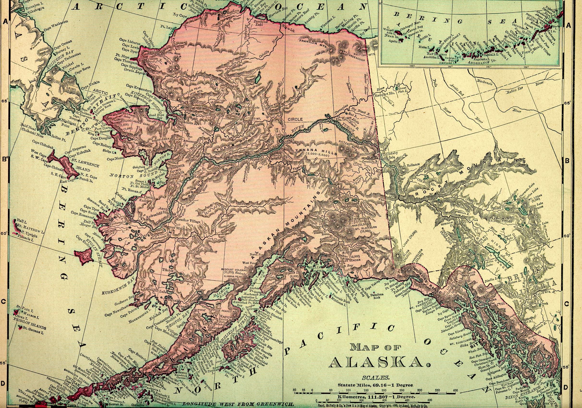
1895 map of Alaska. Heavily detailed. |
On site |
4,310,748 |
2425x1700 |
|
1898
map of the
Alaska and Yukon gold fields. |
On site |
1,809,443 |
1500x1243 |
|
1898
map of routes to the Klondike. |
On site |
303,471 |
640x250 |
|
1898 map of Chilkoot and
White Passes |
On site |
683,628 |
900x554 |
|
1898
map of the
Klondike gold fields and Dawson |
On site |
591,874 |
1407x1145 |
| January,
1901 map showing the new Alaska gold fields. |
On site |
4,455,126 |
1488x998 |
|
1905 map showing Alaska's railroads and
telegraph lines. Relative importance of individual communities is also
shown on the map. |
On site |
3,185,817 |
2221x1638 |
|
1915 US Department of the Interior map showing Army & Navy radio
stations, telegraph offices, railroads and post offices. |
On site |
1,892,749 |
2450x1767 |
|
1917 US Department of the Interior map of Alaska showing reindeer
stations and public schools for Alaskan natives. |
On site |
5,037,026 |
3845x2703 |
|
1918 map
of Alaska showing wagon & sled roads, railroads, and pack trails |
On site |
223,408 |
800x610 |
| |
|
|
|
| |
|
|
|
|
MODERN STATE MAPS |
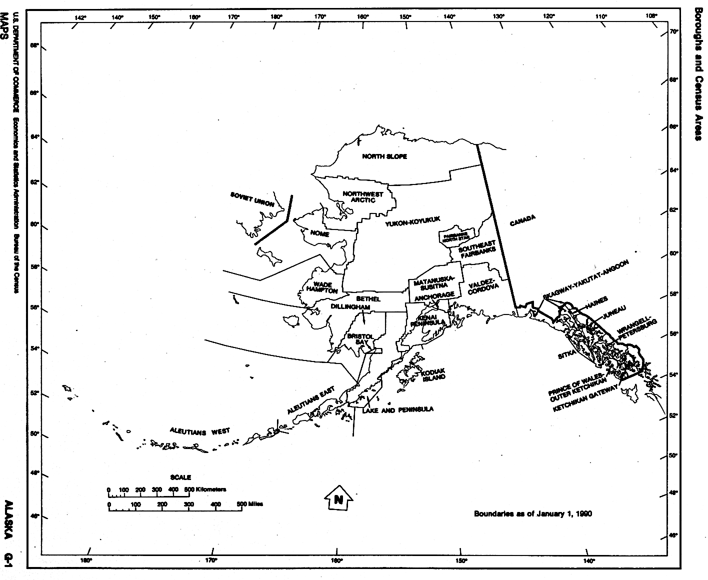
| January 1,
1990 map showing Alaska's boroughs & census areas |
On site |
73,063 |
1416x1160 |
|
1990 map of Alaska showing all of the state and some of the communities.
The Aleutians are shown in full length. |
On site |
1,400,011 |
3614x1713 |
|
1997 relief map of Alaska. This is a beautiful map that shows all
of Alaska's mountain ranges. |
On site |
263,173 |
800x777 |
| |
|
|
|
| |
|
|
|
|
REGIONAL AND LOCAL MAPS |
|
2003 map
of the Alaska Peninsula. |
On site |
350,070 |
656x532 |
| Map of the
main body
of Alaska. No date. |
On site |
971,991 |
932x1024 |
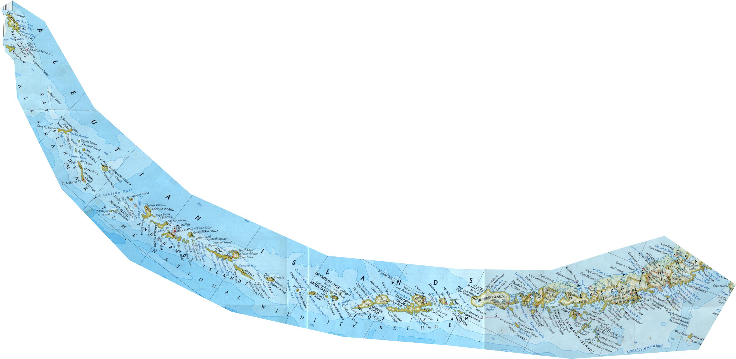
| Map of the
Aleutians. Large enough to see all the villages. |
On site |
676,477 |
2523x1231 |
| Map of Alaska's
western islands. |
On site |
426,090 |
741x1167 |
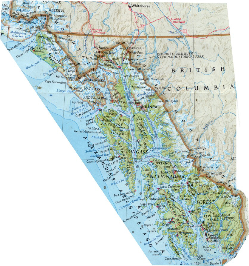
| Map of Alaska's
Southeast region. |
On site |
578,983 |
835x891 |
| |
|
|
|
| |
|
|
|

|
