|
Slana
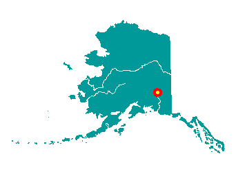 Slana
stretches along the Nabesna Road, which runs south of the Tok Cutoff at
mile 63. It lies at the junction of the Slana and Copper Rivers, 53
miles southwest of Tok. It lies at approximately 62° 42' N Latitude,
143° 57' W Longitude (Sec. 29, T011N, R008E, Copper River Meridian). The
community is located in the Chitina Recording District. The area
encompasses 17 sq. miles of land and 0 sq. miles of water. Slana
stretches along the Nabesna Road, which runs south of the Tok Cutoff at
mile 63. It lies at the junction of the Slana and Copper Rivers, 53
miles southwest of Tok. It lies at approximately 62° 42' N Latitude,
143° 57' W Longitude (Sec. 29, T011N, R008E, Copper River Meridian). The
community is located in the Chitina Recording District. The area
encompasses 17 sq. miles of land and 0 sq. miles of water.
Slana is an Indian village name,
derived from the river's name. The Nabesna Mine opened in 1923, which
employed 60 people at its height. Over thirty different minerals were
extracted from this site, although gold was the primary source of
profit. It operated sporadically through the late 1940s. Slana developed
rapidly in the 1980s when homesteads were offered for settlement by the
federal government.
|
