|
Northway Village
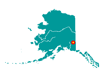
Northway Village is located between
Nabesna River and Skate Lake, on a 9-mile spur road off of the Alaskan
Highway. It lies in the Tetlin National Wildlife Refuge, 42 miles from
the Canadian border. Northway presently consists of three dispersed
settlements: Northway Junction, at milepost 1264, Northway, at the
airport, and the Native village, 2 miles north of the airport. It lies
at approximately 62° 59' N Latitude, 141° 57' W Longitude . The
community is located in the Fairbanks Recording District. The area
encompasses 4 sq. miles of land and 0 sq. miles of water.
 The
area around Northway was first utilized by semi-nomadic Athabascans who
pursued seasonal subsistence activities in the vicinity of Scottie and
Gardiner Creeks and Chisana, Nabesna, and Tanana Rivers. Their first
contacts with white people probably occurred in the late 1880s during
periodic trips to trading posts along the Yukon River. White traders
entered the region as early as 1912, and by the 1920s, had established
trading posts at Gardiner Creek and along the Nabesna River. Nabesna,
the first settlement in the area, was located across the Nabesna River
from the site now occupied by Northway Village. The
area around Northway was first utilized by semi-nomadic Athabascans who
pursued seasonal subsistence activities in the vicinity of Scottie and
Gardiner Creeks and Chisana, Nabesna, and Tanana Rivers. Their first
contacts with white people probably occurred in the late 1880s during
periodic trips to trading posts along the Yukon River. White traders
entered the region as early as 1912, and by the 1920s, had established
trading posts at Gardiner Creek and along the Nabesna River. Nabesna,
the first settlement in the area, was located across the Nabesna River
from the site now occupied by Northway Village.
Flooding led to the abandonment of
Nabesna in the 1940s. Residence at the new site provided Native workers
with construction jobs on the Alaska Highway and at the Northway
airfield during World War II. A post office was first established in
1941. In 1942, the name of the village was changed to Northway to honor
the village chief, T'aiy Ta', who had adopted the name Northway from a
riverboat captain who traveled the Tanana and Nabesna Rivers in the
early 1900s. Chief Walter Northway was thought to be 117 years old at
the time of his death in 1993.
|
