|
Meyers Chuck
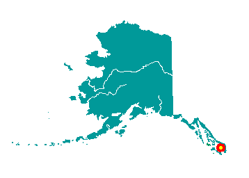
Meyers Chuck is located along Clarence
Strait on the northwest tip of Cleveland Peninsula. It lies 40 miles
northwest of Ketchikan. It lies at approximately 55° 44' N Latitude,
132° 15' W Longitude (Sec. 05, T071S, R086E, Copper River Meridian). The
community is located in the Ketchikan Recording District. The area
encompasses 8 sq. miles of land and 3 sq. miles of water.
 The
natural, well protected harbor has long been shelter for fishing boats
caught in the stormy waters of Clarence Strait. White settlers began
living year-round at Meyers Chuck by the late 1800s. In 1916, a cannery
was established at Union Bay. From 1916 to 1945, local fishermen sold
their catch to Union Bay Cannery, which in turn, sold in bulk to Japan.
In the 1920s, a saltery mild-cured king salmon. A floating clam cannery
and a herring reduction plant were also present in the area during this
time. A post office, store, machine shop, barber shop, bakery and bar
developed to support residents. By 1939, 107 residents lived year-round
in Meyers Chuck. When fish runs began to decline in the 1940s, many
people left the community to join the armed forces or to work at
war-time production jobs in the Lower 48. The Union Bay cannery burned
down in 1947. Lonesome Pete, Greasy Gus, and other colorful characters
remained in Meyers Chuck over the years. Land was patented to local
residents between 1965 and 69, and the community was withdrawn from the
Tongass National Forest. In 1977, five residents donated funds to
establish a fish hatchery. A school was constructed in 1983, but is no
longer staffed. After two major fires in the summer of 1983, residents
pooled their resources to establish a fund to purchase fire-fighting
equipment. A State land disposal sale was offered in 1986. The
natural, well protected harbor has long been shelter for fishing boats
caught in the stormy waters of Clarence Strait. White settlers began
living year-round at Meyers Chuck by the late 1800s. In 1916, a cannery
was established at Union Bay. From 1916 to 1945, local fishermen sold
their catch to Union Bay Cannery, which in turn, sold in bulk to Japan.
In the 1920s, a saltery mild-cured king salmon. A floating clam cannery
and a herring reduction plant were also present in the area during this
time. A post office, store, machine shop, barber shop, bakery and bar
developed to support residents. By 1939, 107 residents lived year-round
in Meyers Chuck. When fish runs began to decline in the 1940s, many
people left the community to join the armed forces or to work at
war-time production jobs in the Lower 48. The Union Bay cannery burned
down in 1947. Lonesome Pete, Greasy Gus, and other colorful characters
remained in Meyers Chuck over the years. Land was patented to local
residents between 1965 and 69, and the community was withdrawn from the
Tongass National Forest. In 1977, five residents donated funds to
establish a fish hatchery. A school was constructed in 1983, but is no
longer staffed. After two major fires in the summer of 1983, residents
pooled their resources to establish a fund to purchase fire-fighting
equipment. A State land disposal sale was offered in 1986.
|
