|
McGrath
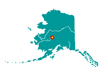
McGrath is located 221 miles northwest of
Anchorage and 269 miles southwest of Fairbanks in Interior Alaska. It is
adjacent to the Kuskokwim River directly south of its confluence with
the Takotna River. It lies at approximately 62° 57' N Latitude, 155° 35'
W Longitude (Sec. 18, T033N, R033W, Seward Meridian). The community is
located in the Mt. McKinley Recording District. The area encompasses 38
sq. miles of land and 5 sq. miles of water.
 McGrath
was a seasonal Upper Kuskokwim Athabascan village which was used as a
meeting and trading place for Big River, Nikolai, Telida and Lake
Minchumina residents. The Old Town McGrath site, was originally located
across the river. In 1904, Abraham Appel established a trading post at
the old site. In 1906, gold was discovered in the Innoko District, and
at Ganes Creek in 1907. Since McGrath is the northernmost point on the
Kuskokwim River accessible by large riverboats, it became a regional
supply center. McGrath
was a seasonal Upper Kuskokwim Athabascan village which was used as a
meeting and trading place for Big River, Nikolai, Telida and Lake
Minchumina residents. The Old Town McGrath site, was originally located
across the river. In 1904, Abraham Appel established a trading post at
the old site. In 1906, gold was discovered in the Innoko District, and
at Ganes Creek in 1907. Since McGrath is the northernmost point on the
Kuskokwim River accessible by large riverboats, it became a regional
supply center.
By 1907, a town was established, and
was named for Peter McGrath, a local U.S. Marshal. In 1909, the Alaska
Commercial Company opened a store. The Iditarod Trail also contributed
to McGrath's role as a supply center. From 1911 to 1920, hundreds of
people walked and mushed over the Trail on their way to the Ophir gold
districts. Mining sharply declined after 1925. After a major flood in
1933, some residents decided to move to the south bank of the River.
Changes in the course of the River eventually left the old site on a
slough, useless as a river stop. In 1937, the Alaska Commercial Company
opened a store at the new location. In 1940, an airstrip was cleared,
the FAA built a communications complex, and a school was opened. McGrath
became an important refueling stop during World War II, as part of the
Lend-Lease Program between the U.S. and Russia. In 1964, a new high
school was built, attracting boarding students from nearby villages.
|
