|
|
|
Marshall
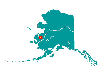
Marshall is located on the north bank of
Polte Slough, north of Arbor Island, on the east bank of the Yukon River
in the Yukon-Kuskokwim Delta. It lies on the northeastern boundary of
the Yukon Delta National Wildlife Refuge. It lies at approximately 61°
53' N Latitude, 162° 05' W Longitude (Sec. 27, T021N, R070W, Seward
Meridian). The community is located in the Bethel Recording District.
The area encompasses 5 sq. miles of land and 0 sq. miles of water.
 An
expedition came upon an Eskimo village at this site in 1880, called "Uglovaia."
Gold was discovered on nearby Wilson Creek in 1913. "Fortuna Ledge"
became a placer mining camp, named after the first child born at the
camp, Fortuna Hunter. Its location on a channel of the Yukon River was
convenient for riverboat landings. A post office was established in
1915, and the population grew to over 1,000. Later the village was named
for Thomas Riley Marshall, Vice President of the United States under
Woodrow Wilson from 1913-21. The community became known as "Marshall's
Landing." When the village incorporated as a second-class city in 1970,
it was named Fortuna Ledge, but was commonly referred to as Marshall.
The name was officially changed to Marshall in 1984. An
expedition came upon an Eskimo village at this site in 1880, called "Uglovaia."
Gold was discovered on nearby Wilson Creek in 1913. "Fortuna Ledge"
became a placer mining camp, named after the first child born at the
camp, Fortuna Hunter. Its location on a channel of the Yukon River was
convenient for riverboat landings. A post office was established in
1915, and the population grew to over 1,000. Later the village was named
for Thomas Riley Marshall, Vice President of the United States under
Woodrow Wilson from 1913-21. The community became known as "Marshall's
Landing." When the village incorporated as a second-class city in 1970,
it was named Fortuna Ledge, but was commonly referred to as Marshall.
The name was officially changed to Marshall in 1984.
|
|
|
