|
|
|
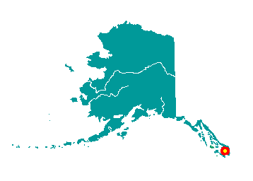
Ketchikan
Ketchikan is located on the western coast
of Revillagigedo Island, near the southernmost boundary of Alaska. It is
679 miles north of Seattle and 235 miles south of Juneau. The 2.2
million acre Misty Fiords National Monument lies 22 air miles east of
Ketchikan. It is the first Alaska port of call for northbound cruise
ships and State ferries. It lies at approximately 55° 20' N Latitude,
131° 38' W Longitude (Sec. 30, T075S, R091E, Copper River Meridian). The
community is located in the Ketchikan Recording District. The area
encompasses 3 sq. miles of land and 1 sq. miles of water.
 Tongass
and Cape Fox Tlingits have used Ketchikan Creek as a fish camp which
they called "kitschk-hin," meaning creek of the "thundering wings of an
eagle." The abundant fish and timber resources attracted non-Natives to
Ketchikan. In 1885, Mike Martin bought 160 acres from Chief Kyan, which
later became the township. The first cannery opened in 1886 near the
mouth of Ketchikan Creek and four more were built by 1912. The Ketchikan
Post Office was established in 1892. In the late 1890s, nearby gold and
copper discoveries briefly brought activity to Ketchikan as a mining
supply center. Tongass
and Cape Fox Tlingits have used Ketchikan Creek as a fish camp which
they called "kitschk-hin," meaning creek of the "thundering wings of an
eagle." The abundant fish and timber resources attracted non-Natives to
Ketchikan. In 1885, Mike Martin bought 160 acres from Chief Kyan, which
later became the township. The first cannery opened in 1886 near the
mouth of Ketchikan Creek and four more were built by 1912. The Ketchikan
Post Office was established in 1892. In the late 1890s, nearby gold and
copper discoveries briefly brought activity to Ketchikan as a mining
supply center.
By 1936, seven canneries were in operation, producing 1.5 million
cases of salmon. The need for lumber for new construction and packing
boxes spawned the Ketchikan Spruce Mills in 1903, which operated for
over 70 years. Spruce was in high demand during World War II, and
Ketchikan became a supply center for area logging. A $55 million pulp
mill was constructed at Ward Cove near Ketchikan in 1954. Its operation
fueled the growth of the community. The mill's 50-year contract with the
U.S. Forest service for timber was canceled, and the pulp mill closed in
March 1997.
|
|
|
