|
Huslia
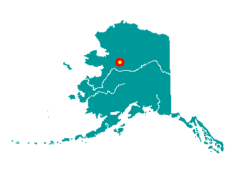
Huslia is located on the north bank of the
Koyukuk River, about 170 river miles northwest of Galena and 290 air
miles west of Fairbanks. It lies within the Koyukuk National Wildlife
Refuge. It lies at approximately 65° 41' N Latitude, 156° 24' W
Longitude (Sec. 33, T004N, R012E, Kateel River Meridian). The community
is located in the Nulato Recording District. The area encompasses 16 sq.
miles of land and 1 sq. miles of water.
 The
Koyukon Athabascans lived between the south fork of the Koyukuk River
and the Kateel River. They had spring, summer, fall, and winter camps,
and moved as the wild game migrated. In the summer many families would
float on a raft to the Yukon to fish for salmon. The Koyukon often
traded with the Kobuk River Eskimos. By 1843, Russian explorers had made
contact with Athabascans approximately 50 miles downriver from the
current site. The Western Union Telegraph Company explored the River
around 1867, and missionary activity increased after 1870. Cutoff
Trading Post (also called Old Town) was established in the 1920s about 4
miles overland, or 16 river miles, from modern Huslia. The
Koyukon Athabascans lived between the south fork of the Koyukuk River
and the Kateel River. They had spring, summer, fall, and winter camps,
and moved as the wild game migrated. In the summer many families would
float on a raft to the Yukon to fish for salmon. The Koyukon often
traded with the Kobuk River Eskimos. By 1843, Russian explorers had made
contact with Athabascans approximately 50 miles downriver from the
current site. The Western Union Telegraph Company explored the River
around 1867, and missionary activity increased after 1870. Cutoff
Trading Post (also called Old Town) was established in the 1920s about 4
miles overland, or 16 river miles, from modern Huslia.
In 1949, the community moved to the
present site because Cutoff flooded frequently and the ground was
swampy. Huslia (originally spelled Huslee) was named after a local
stream. Huslia had been used as a burial site since 1886, but by the
time of the move, most of the old cemetery had been destroyed by
erosion. In 1950, the first school was established, followed by a post
office, airport and road construction in 1952. At this time, families
began to live year-round at Huslia. In 1960, a health clinic was
constructed, and in 1963, 29 individual hand-pumped water wells were
installed. Running water and indoor plumbing arrived in 1974.
|
