|
|
|
Circle
 Circle
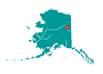
is located on the south bank of the Yukon River at the edge of the Yukon
Flats, 160 miles northeast of Fairbanks. It is at the eastern end of the
Steese Highway. It lies at approximately 65° 49' N Latitude, 144° 03' W
Longitude (Sec. 31, T012N, R018E, Fairbanks Meridian). The community is
located in the Fairbanks Recording District. The area encompasses 5 sq.
miles of land and 1 sq. miles of water.
Circle (also known as Circle City) was established in 1893 as a
supply point for goods shipped up the Yukon River and then overland to
the gold mining camps. Early miners believed the town was located on the
Arctic Circle, and named it Circle. By 1896, before the Klondike gold
rush, Circle was the largest mining town on the Yukon, with a population
of 700. It boasted an Alaska Commercial Company store, eight or ten
dance halls, an opera house, a library, a school, a hospital, and an
Episcopal Church. It had its own newspaper, the Yukon Press, and a
number of residential U.S. government officials, including a
commissioner, marshal, customs inspector, tax collector and postmaster.
The town was virtually emptied after gold discoveries in the Klondike
(1897) and Nome (1899). A few hearty miners stayed on in the Birch Creek
area, and Circle became a small, stable community that supplied miners
in the nearby Mastodon, Mammoth, Deadwood and Circle Creeks. Mining
activity continues to this day.
The population of Circle is predominantly Athabascan, but there are
several non-Native families. The Circle Civic Community Association was
formed in 1967. It cooperates with the traditional council in
maintaining the sign area and public boat launch and in preserving
historic sites.
|
|
|
