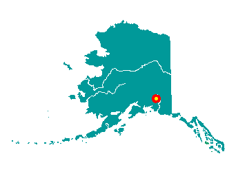
 Chistochina
is located at mile 32.7 on the Tok Cutoff to the Glenn Highway, 42 miles
northeast of Glennallen. Sinona Creek, Bolder Creek, Chistochina River
and Copper River surround the village. It lies at approximately 62° 34'
N Latitude, 144° 40' W Longitude (Sec. 16, T009N, R004E, Copper River
Meridian). The community is located in the Chitina Recording District.
The area encompasses 17 sq. miles of land and 0 sq. miles of water.
Chistochina
is located at mile 32.7 on the Tok Cutoff to the Glenn Highway, 42 miles
northeast of Glennallen. Sinona Creek, Bolder Creek, Chistochina River
and Copper River surround the village. It lies at approximately 62° 34'
N Latitude, 144° 40' W Longitude (Sec. 16, T009N, R004E, Copper River
Meridian). The community is located in the Chitina Recording District.
The area encompasses 17 sq. miles of land and 0 sq. miles of water.
Chistochina began as an Ahtna fish camp and a stopover place for
traders and trappers. The village access road later became part of the
Valdez-Eagle Trail, constructed by miners during the gold rush to the
Eagle area in 1897. Chistochina Lodge was built as a roadhouse for
prospectors. The Trail was used for construction of U.S. Army Signal
Corps telegraph lines from Valdez to Eagle between 1901 and 1904. Gold
was mined along the upper Chistochina River and its runoff creeks. The
area was settled by homesteaders, although it has remained a traditional
Native village.
